- Joined
- Jun 16, 2014
- Messages
- 14,673
- Reaction score
- 3,113
- Location
- UP of Michigan
- Gender
- Male
- Political Leaning
- Independent
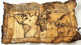
Mercator projection maps are horrible.The map is drawn in a format (Mercator projection) which wasn't invented until the late 1600's It's also centred on the Prime Meridian running through Greenwich, England which was not established till 1850 ish. Definitely fake.


You don't.How do you get an accurate map of America back then?
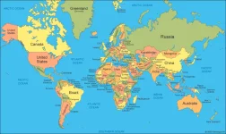
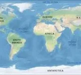
It's weird that Australia is three times the size of Greenland.Mercator projection maps are horrible.
Look at one, then remember Africa is 14 times bigger than Greenland.
View attachment 67554888
View attachment 67554890
It could be from a parallel realm, check for tachyon radiation.You don't.
The source is a website called CreepyWorld. Seems legit.5000 Year Old Egyptian Map Depicts America:
How do you get an accurate map of America back then?
I don't know if the picture they show is of the actual map, they show another picture the rest of the video.
Anybody?
Oh, something from one of the other realms, some parchment, with a map that would fade, be copied.The source is a website called CreepyWorld. Seems legit.
A 5000-year-old Egyptian map could not have even accurately depicted Egypt, much less America.
Oh, something from one of the other realms, some parchment, with a map that would fade, be copied.
Can't rule it out.
So it goes in the "don't know" pile.
I'd have to see some more data, but like I say, if I had to lay money, the choice is pretty clear.
I remember from maybe the 70's weak proof that there were visitors across the Atlantic. They demonstrated it could be done from ancient times. called it "The Ra Expedition."Sounds hard to believe. I would question the source.


Well, I agree, if you wanted to preserve a map, you'd put it on stone.
This would be the oldest surviving map by over 1500 years. The oldest-known maps are from Iraq and Greece, aren't even close to this old, and depict only their locale.
And this just happens to depict other continents? Ridiculous. Fake. Next.
It's fake.5000 Year Old Egyptian Map Depicts America:
How do you get an accurate map of America back then?
I don't know if the picture they show is of the actual map, they show another picture the rest of the video.
Anybody?
Probably, but what if it is real?It's fake.
Let me know when it's determined to be real.Probably, but what if it is real?
No consequence, it only confirms the dimensional past we already know about.Probably, but what if it is real?
CreepyWorld is definitely the most reliable source for all my news
What if the election was real, nobody cheated?Probably, but what if it is real?
